

Favorite Places
Software: MAPublisher, ArcGIS, QGIS, Illustrator
Client: Gifts
Gifting is important to me. I love surprising people with maps of sentimental places while challenging myself at the same time. I aim to learn something from every map I make, be it a new GIS process or art-making technique.
Corsica

Corsica | 5 x 7 | Paper
I designed this wedding card for a geographer friend who spent his honeymoon in Corsica. It started as a complicated map with many labels but evolved into a dialogue between paper types with a clean, simple layout. I combined eastern paper with colored card stock for the bathymetry layers, and the result was surprisingly luminous and engraved better than I expected. I contrasted that against 140 lb cover from French Paper for the landmasses and frame.
Queen Village
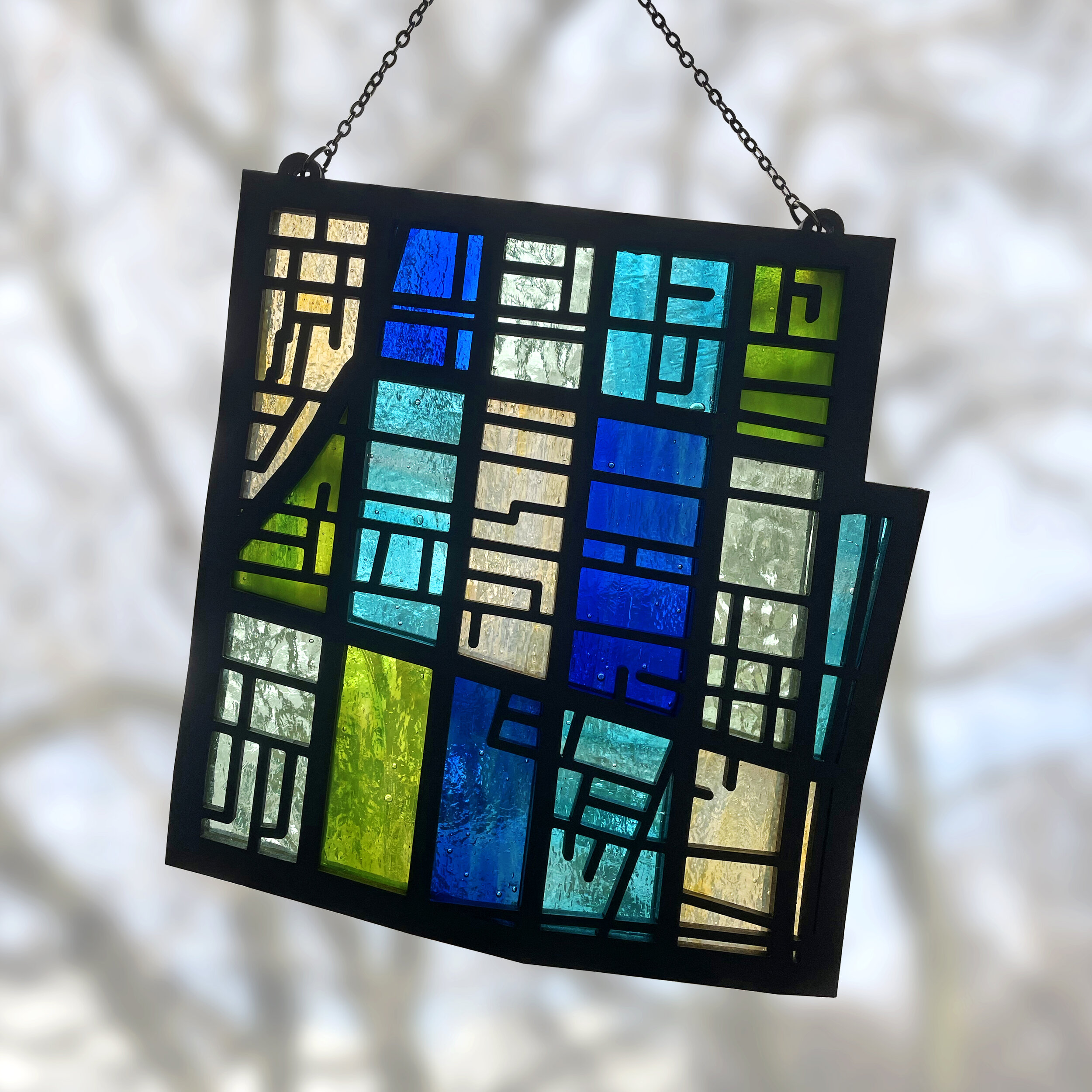
Queen Village, PA | 7 x 8 | Stained glass and MDF
This gift wasn’t exactly a surprise, but the end result was. The recipient asked for a map of her neighborhood, Queen Village in Philadelphia. I didn’t want to go the traditional route so I invented a new technique to house hand-cut stained glass between layers of laser-cut MDF. I hung the map at an angle so it would match the state plane coordinate system for this part of PA. There was a bit of a learning curve to get the technique down, but I had a blast working on it.
Wing’s Neck

Wing’s Neck | 16 x 10 | Maple and walnut plywood

Wing’s Neck, detail
This was by far the most sentimental map I’ve worked on. Part of my stepmom’s family lives on a small point in Cape Cod, and it’s a much-beloved summer getaway for the rest of us. I struggled with what to include on this map since there were so few roads. I settled on building footprints, which both increased the sentimentality and added a semi-abstract visual element without overwhelming the piece.
McMurdo Station

McMurdo Station (Home is where the heart is) | 6 x 6 | Paper, leather, 24k gold leaf, gel pen
A friend of mine typically spends northern-hemisphere winters in McMurdo station in Antarctica, but 2020 and COVID-19 threw a wrench in her plans. I decided to cheer her up with a surprise map. I used the same technique as the Corsica map for the water but branched out from there. The landmasses were too complicated to layer on top of the paper, so I cut the continent out and overlaid the paper on metallic silver leather. I gilded the heart with 24k gold leaf to get a similar level of shine. My initial plan was to leave the graticules dark after engraving, but the layer looked too dull so I filled them in with a gold gel pen.
Mo'orea
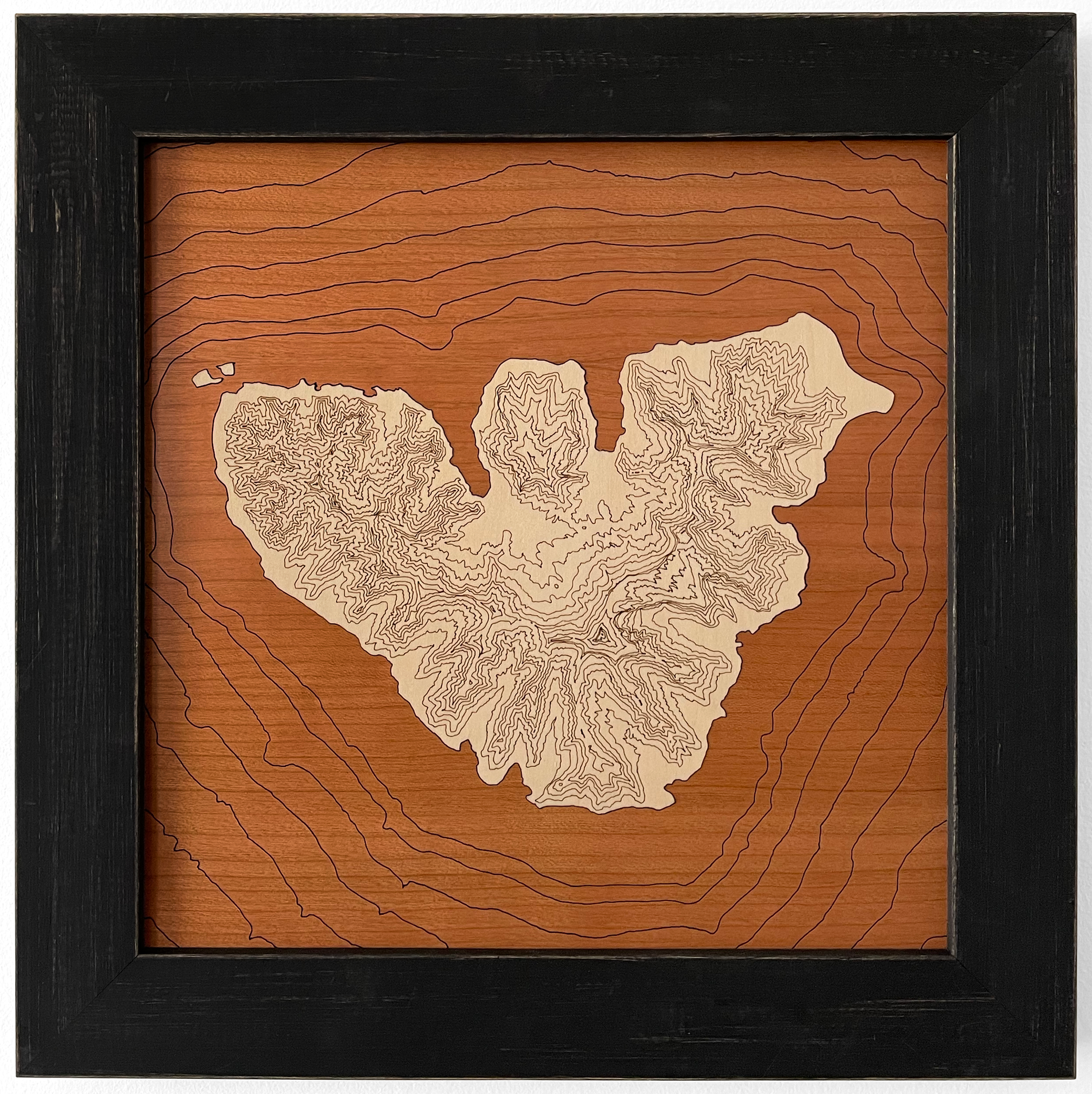
Mo'orea, French Polynesia | 10.5 x 10.5 | Basswood and cherry plywood
I designed this map for an avid diver. I had a clear vision when I started: it was going to be a simple map with bathymetric contours and a solid, un-engraved landmass. However, it felt too sparse when I cut my test piece. Mo'orea is a mountainous island, so I decided to add denser elevation contours to contrast the water. I thought that would be fairly easy since the French government provided detailed data, but unfortunately, engraving looked awful and I wound up spending hours prepping the lines for scoring. It was a lesson in humility if nothing else.