Transshipment Maps

Transshipment Maps
Software: Illustrator, MAPublisher
Client: The Pew Charitable Trusts, International Fisheries
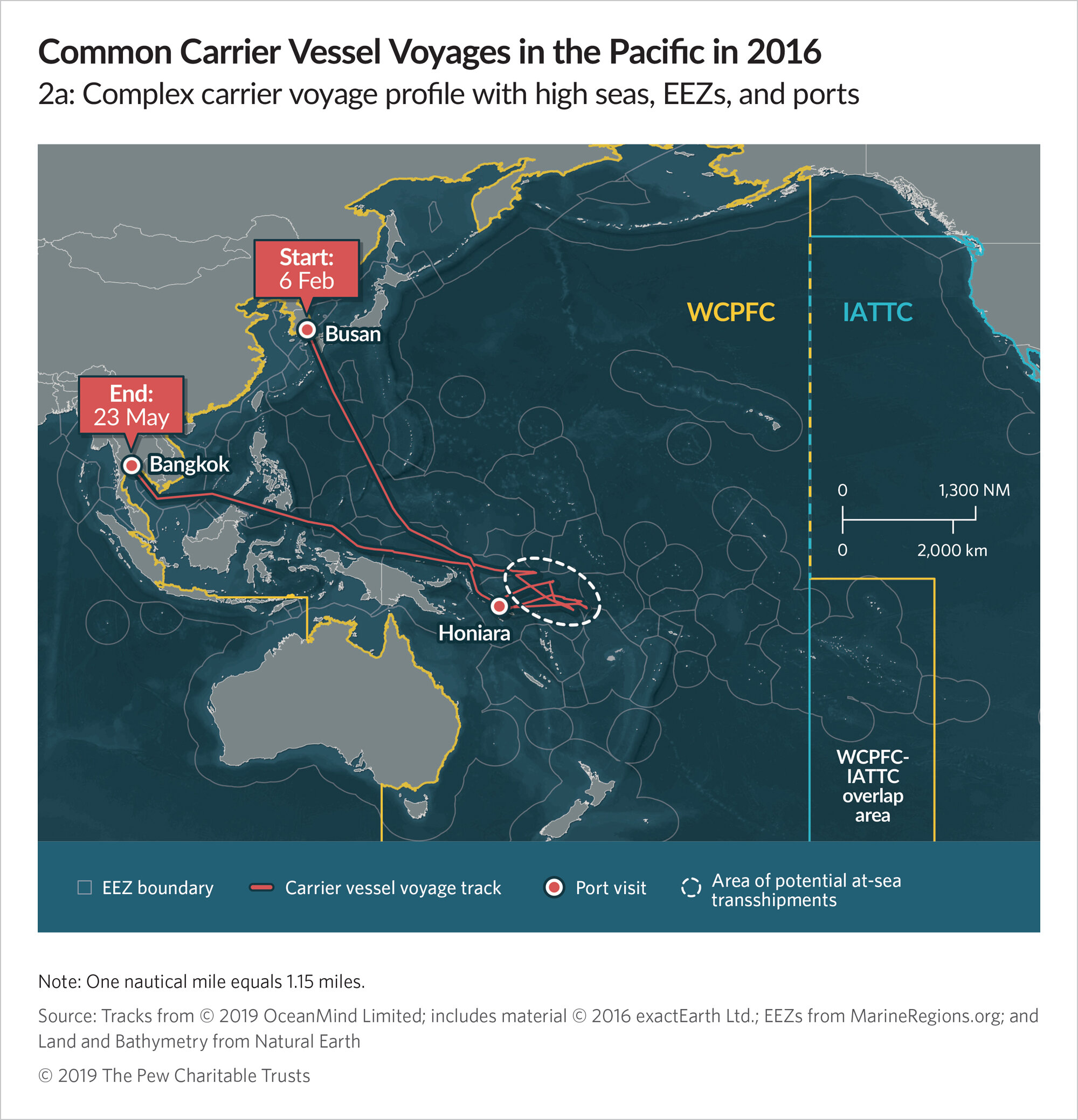
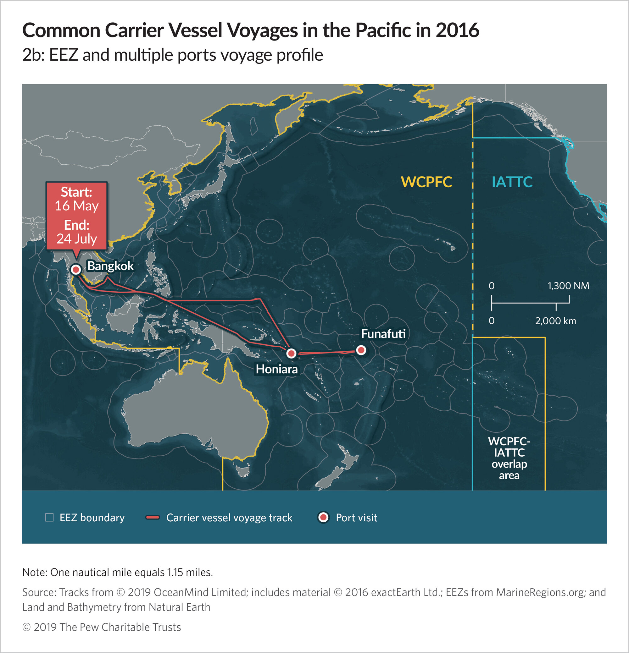
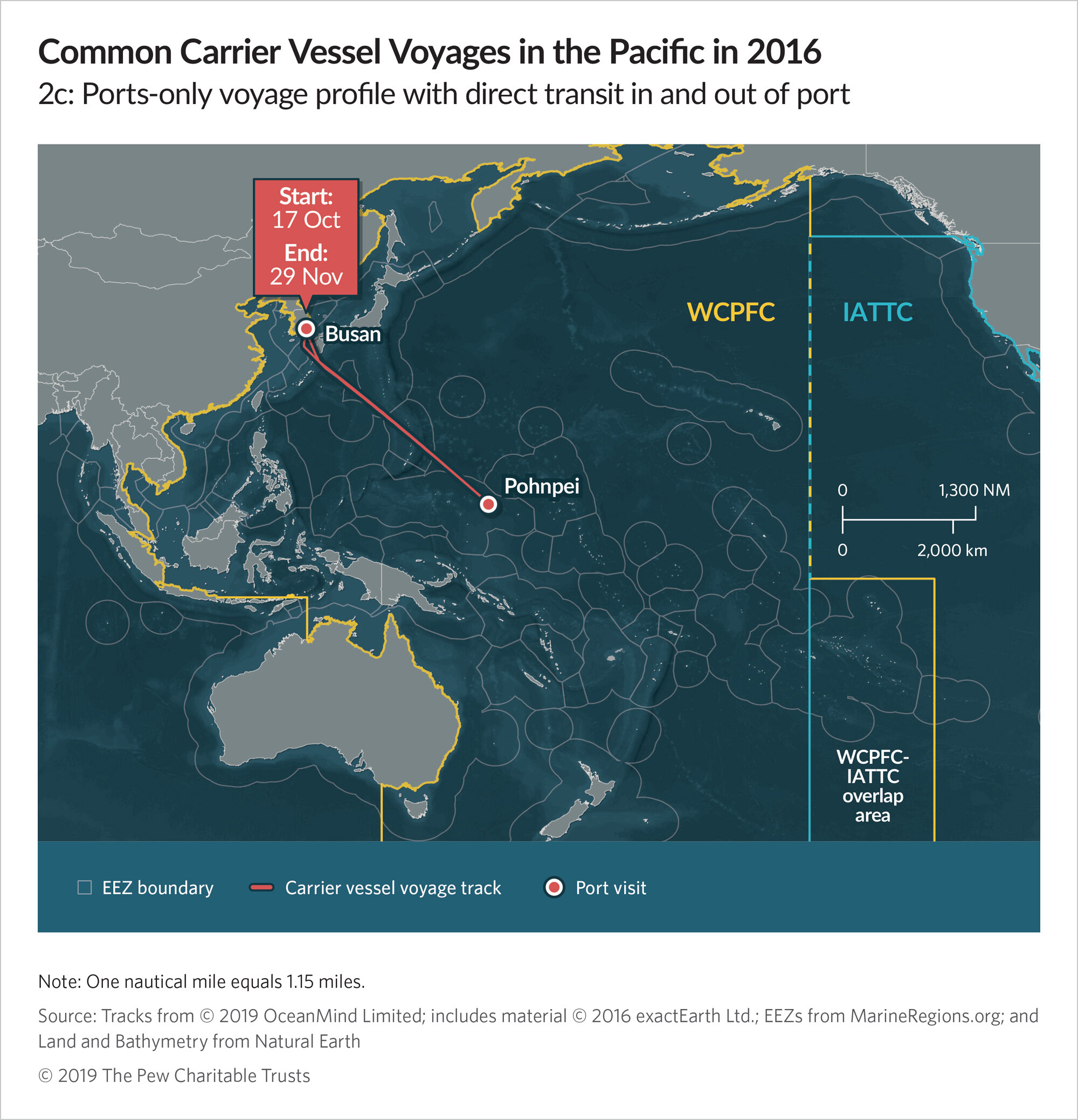
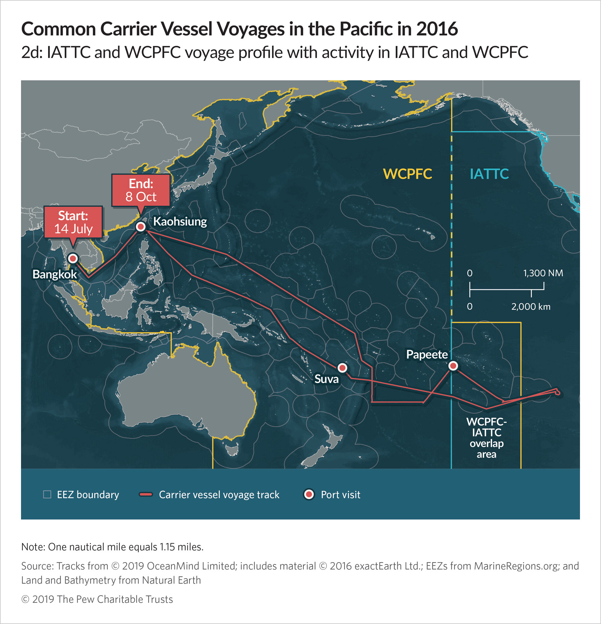
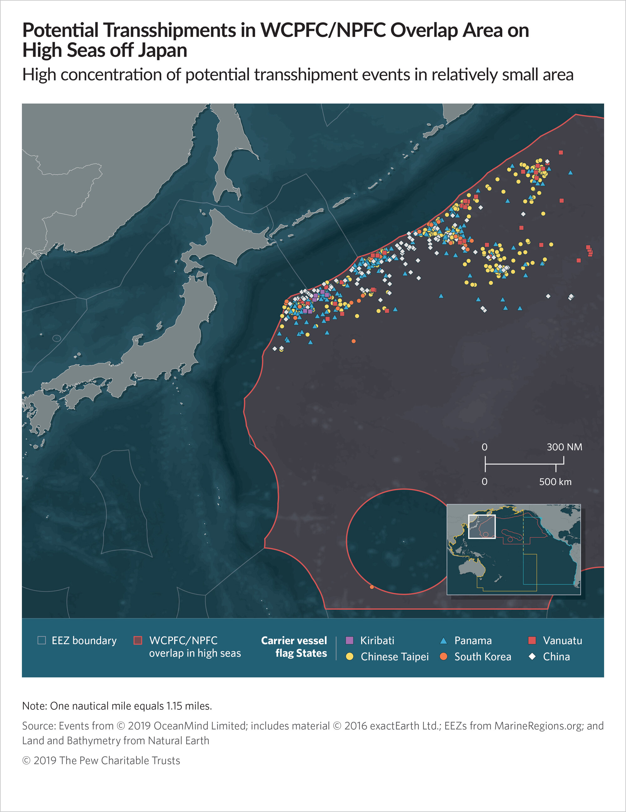
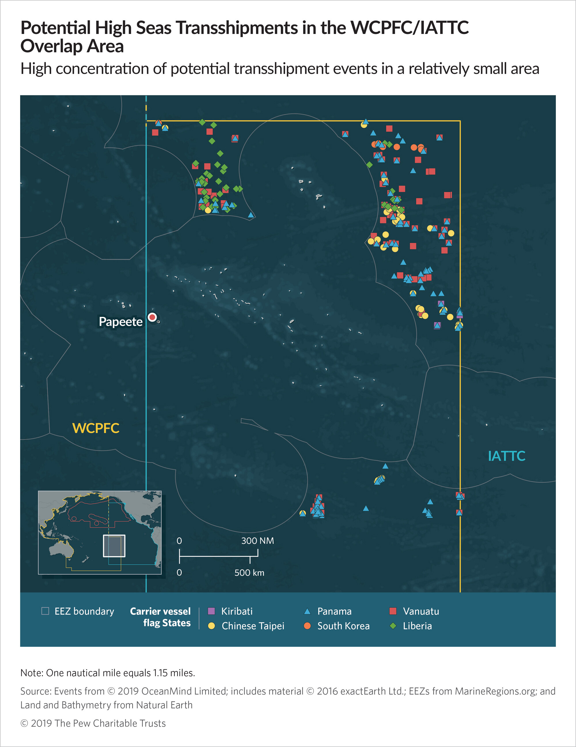
Transshipment is the transfer of goods between vessels while at sea, and unreported transshipment can mask illegal or over-fishing, human trafficking, and other illegal activity. In 2019 Pew released a groundbreaking report that combined vessel tracking information, remote sensing data, and machine learning to identify carrier vessel behavior consistent with transshipment events in the Pacific Ocean, primarily focusing on the area managed by the Western and Central Pacific Fisheries Commission. The study found that transshipment events were significantly under-reported. Through collaboration and many rounds of revisions I designed these maps to be as clear as possible, especially in situations where transshipment events took place between different flag states and symbols overlapped.
Above: Examples of different kinds of vessel voyage behavior. Below: An examination of unauthorized carrier activity with an example track from a single vessel.

The following two maps displaying potential transshipment events between different flag states were the most difficult due to the overlapping symbols. Initially, Panamanian flags dominated the IATTC overlap map and the client almost decided to scratch it. As I tweaked colors and symbol shapes for readability, I realized I could reveal these overlaps without singling out a particular country. I carried the same symbols over into the second map off the coast of Japan.
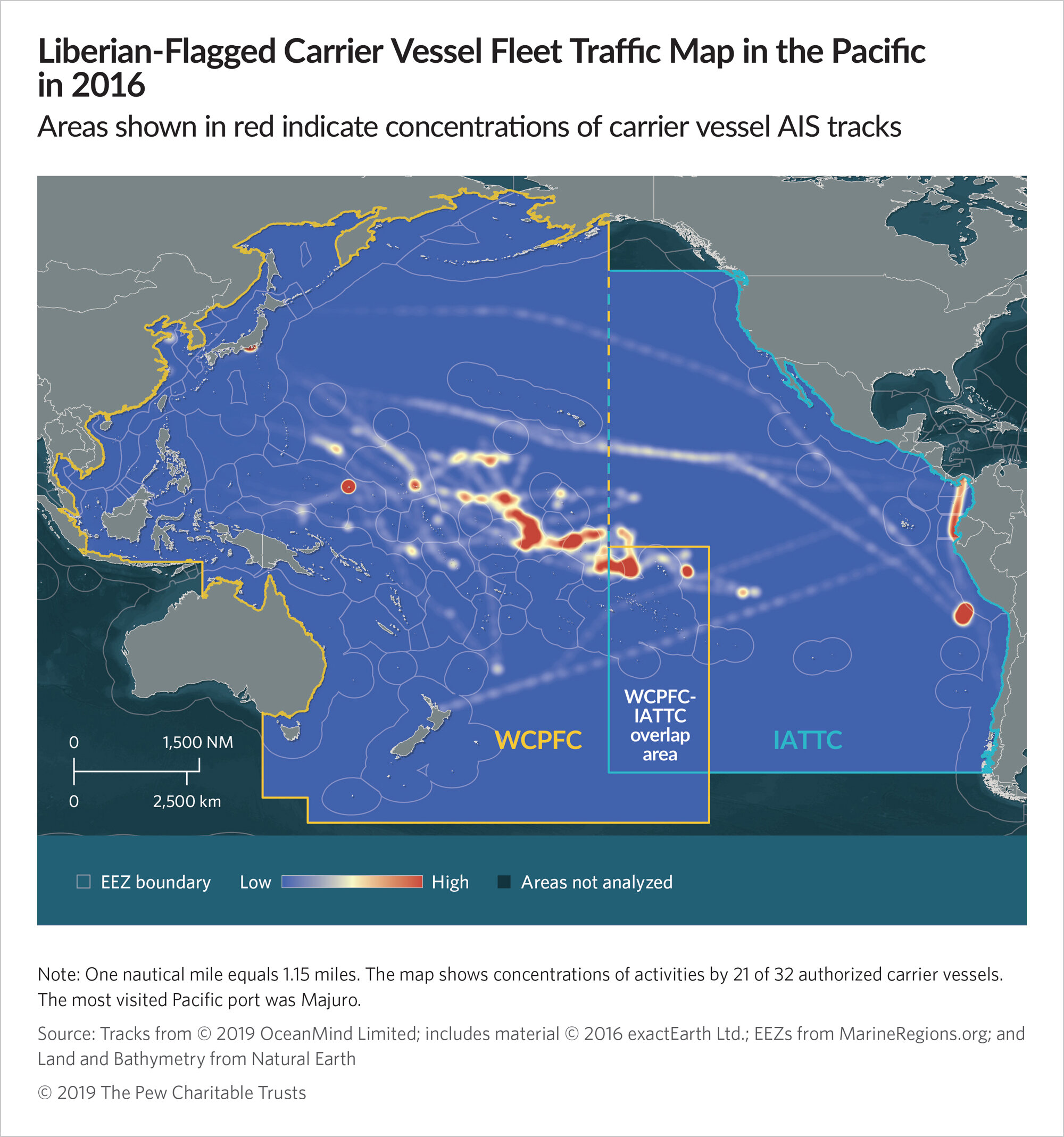
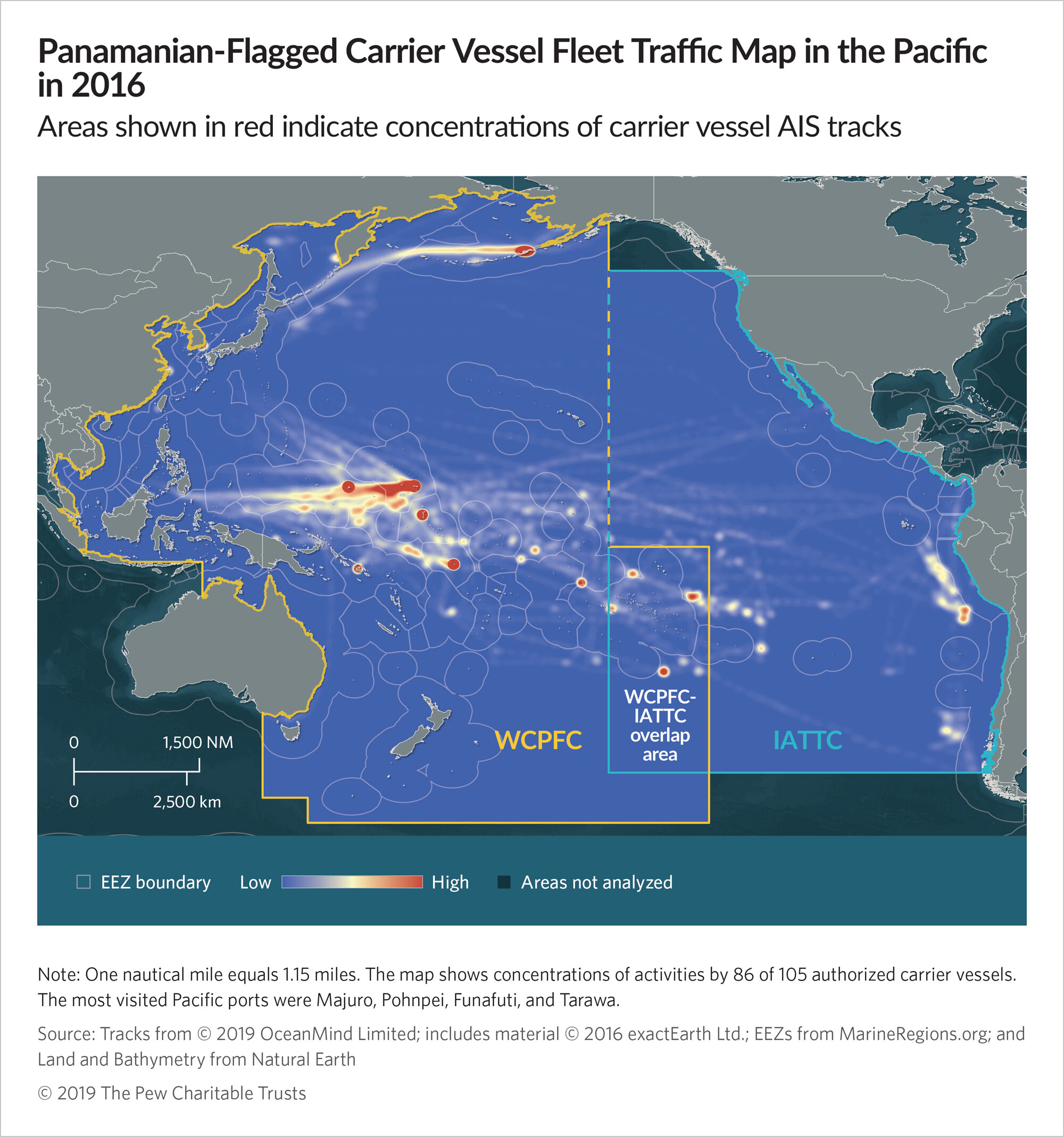
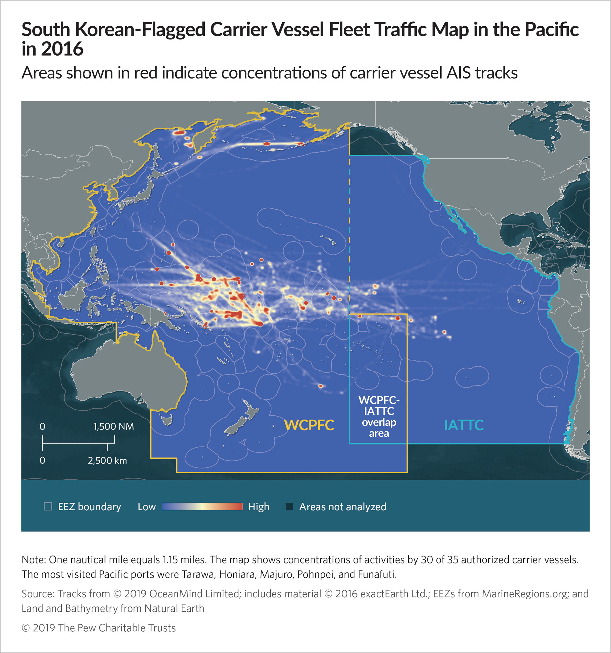
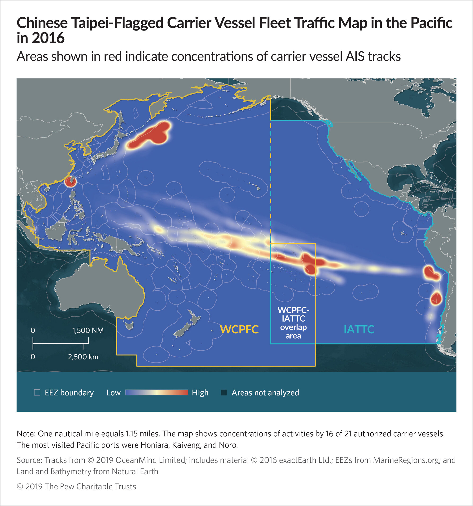
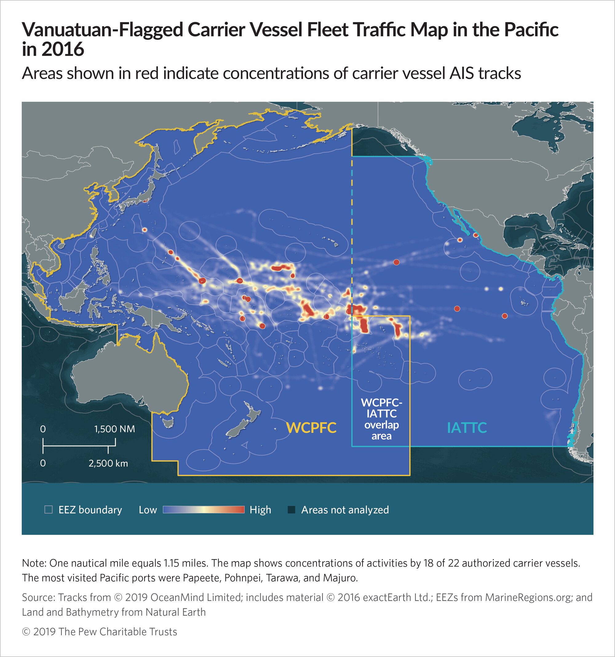
These heatmaps represent carrier fleet density. While density does not imply a greater likelihood of transshipment events in those areas, the maps illuminate the fleets’ movements over time.
